Skip to product information


Made in Maine
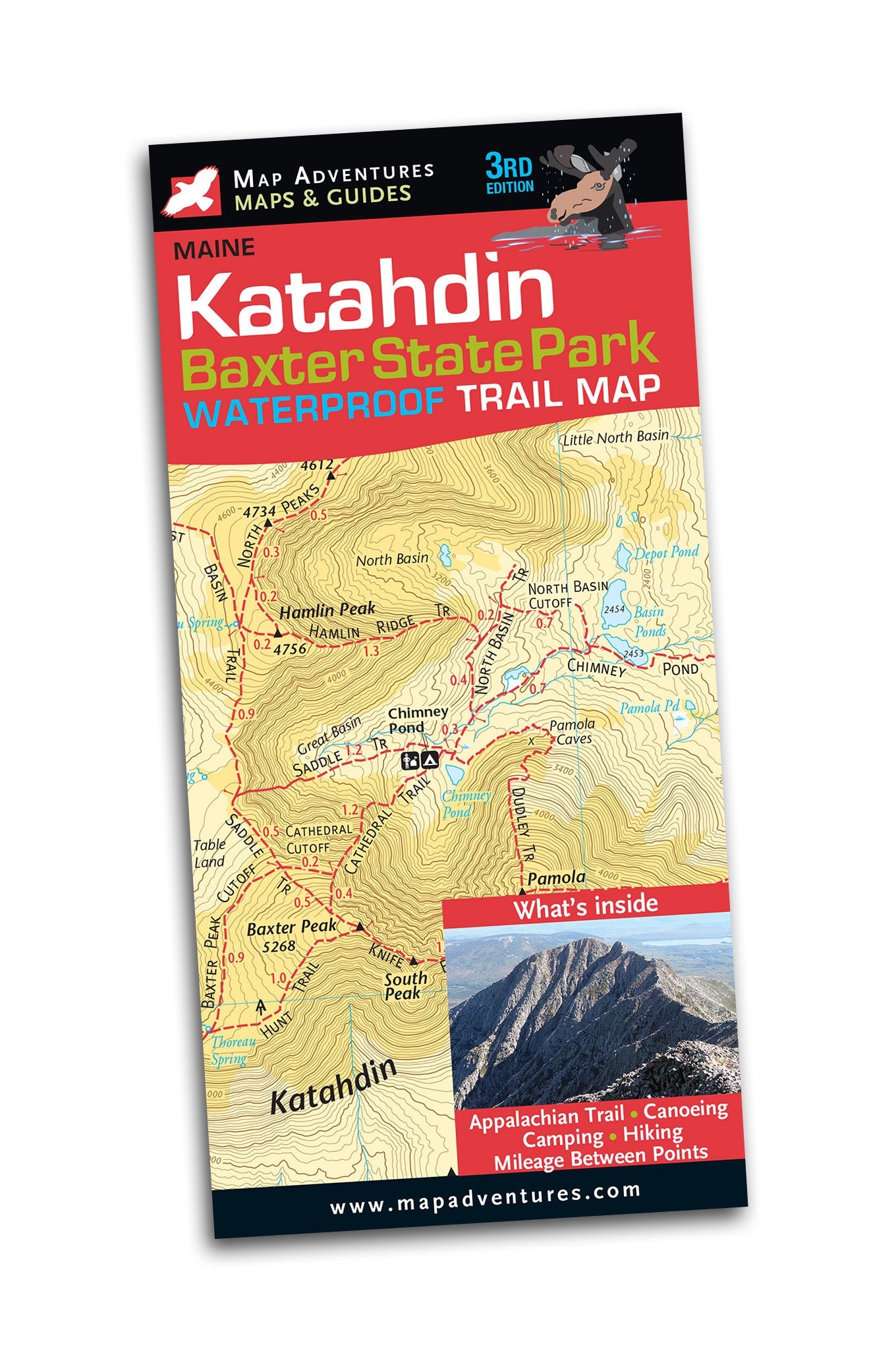
3rd Editon Jaw-dropping beauty and yes, you are likely to see a moose. Let Map Adventures show you why “forever wild” is an understatement when it comes to experiencing Baxter State Park. This beautiful, two-sided, waterproof map shows in great detail the parks 220 miles of hiking trails, highlighting the many lakes, canoeing and camping opportunities also available.
Whether you choose to traverse the Knife Edge, one of the most demanding and ambitious treks in the northeast, seek out an easier trail to explore, or rent a canoe on one of the many quiet lakes, you will experience one of the wildest parts of northern Maine.
Map Features
- Campgrounds
- Backcountry Camp Sites
- Appalachian Trail
- Canoe Rentals
- Mileage between points on hiking trails
- UTM/GIS Grid
- Index of trails
- The entire park on one side (no more flipping the map)
- The other side has content, detail of Katahdin Area
Areas Covered
- Baxter State Park
- The Golden Road
Topographic Map: waterproof | 36”x24” unfolded | ISBN 978-1890060-55-8| scale 1:52 000 and 1:30 000 | Map Adventures LLC
Return Policy
Final Sale. Map Adventures products are not returnable.
The MOB Shop brings together gear and gifts from Maine's outdoor makers. Every purchase goes directly to the founders behind each brand and supports MOB's work connecting, growing, and championing Maine's outdoor entrepreneurs.
Map Adventures was born in 1994. Today, they share their adventures with you by making the best easy-to-use maps and guides. They hope that you too will discover the pleasure of exploring the outdoors with family and friends and dogs–and with a good map in hand! Happy Trails.
Based in Portland, Maine